Figures
To accompany Scoping
for Satsop Forest
Figure 1: Aerial view from
north at 10,00 feet (Back to Scoping)
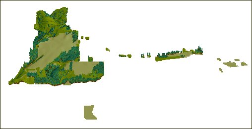
Figure 2: Aerial view from
south at 10,000 feet (Back to Scoping)
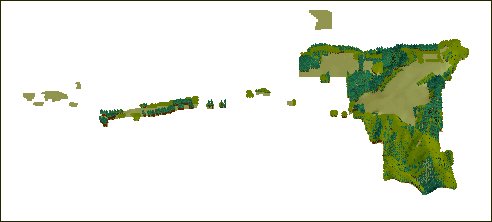
Figure 3: Geographic
distribution of site classes on Satsop Forest (Back to Scoping)
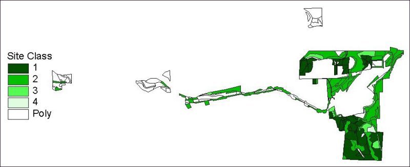
Figure 4 (Back
to Scoping)
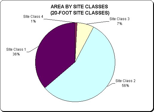
Figure 5 (Back
to Scoping)
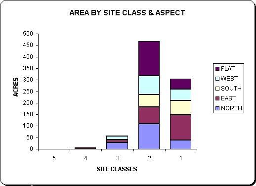
Figure 6 (Back
to Scoping)
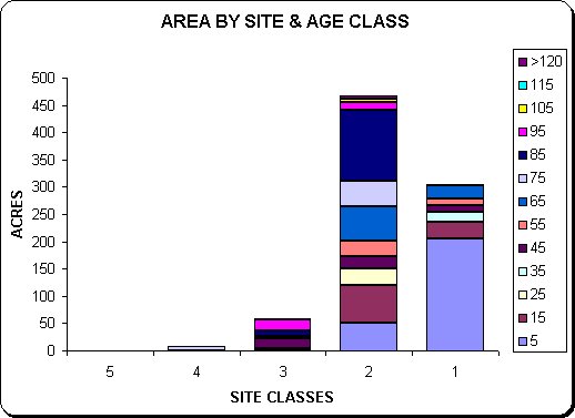
Figure 7 (Back
to Scoping)
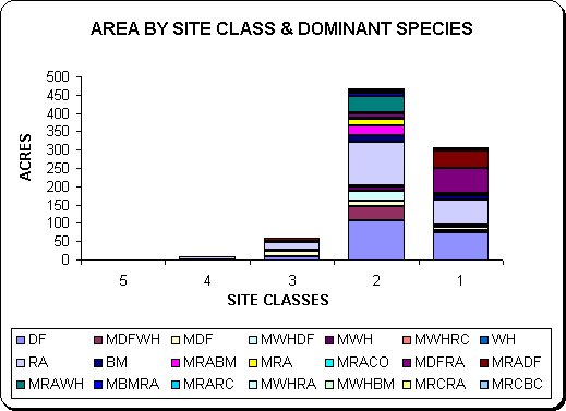
Figure 8: Geographic age distribution
on Satsop Forest (Back to Scoping)
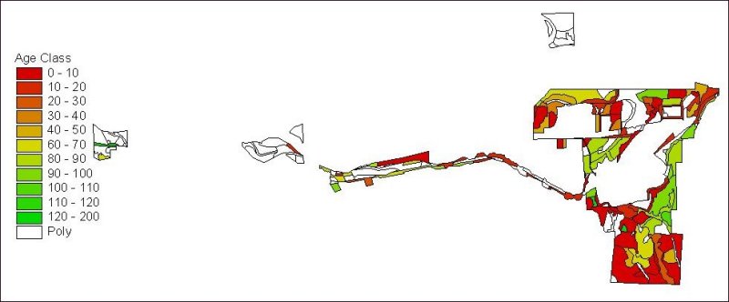
Figure 9 (Back
to Scoping)
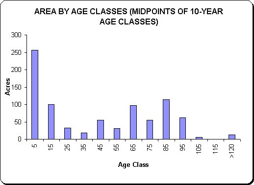
Figure 10 (Back
to Scoping)
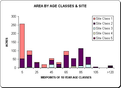
Figure 11 (Back
to Scoping)
Figure 12 (Back
to Scoping)
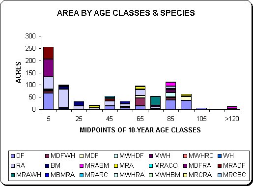
Figure 13 (Back
to Scoping)
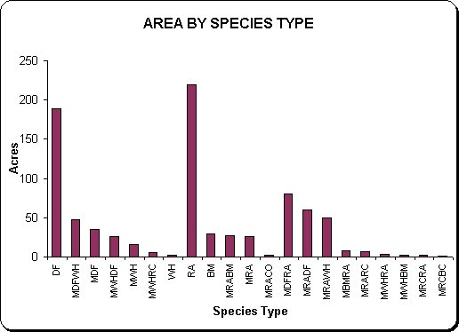
Figure 14 (Back
to Scoping)
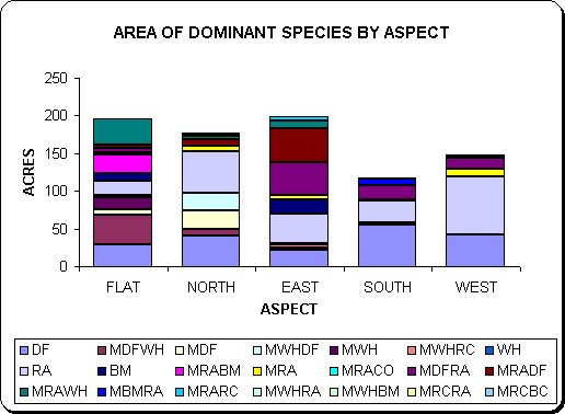
Figure 15: Geographic distribution
of stand types (Conifer, Hardwood, Mixed Conifer/Hardwood,
Mixed Hardwood/Conifer) on Satsop Forest (Back
to Scoping)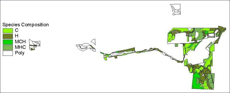
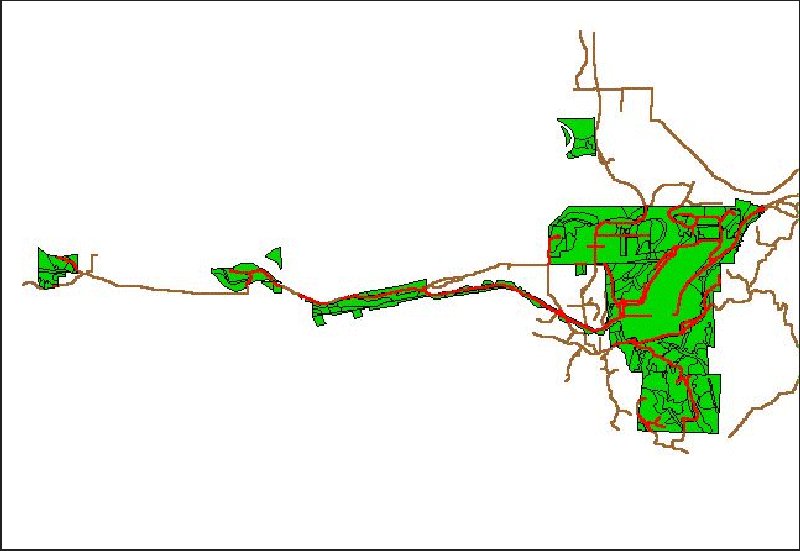
Figure 16: Satsop Forest
road system
and surrounding road system (Back to Scoping)
Updated 13/09/2000
by Kevin 'thujaman" Ceder